What can be found on the ridge of the Ural mountains. What is the highest peak of the Ural Mountains
The Ural Mountains are a ridge on the border of Europe and Asia, as well as a natural border within, to the east of which - Siberia and the Far East, and to the west - the European part of the country.
BELT MOUNTAINS
In the old days, for travelers who approached the Urals from the east or the west, these mountains really seemed to be a belt that had seized the plain tightly, dividing it into the Urals and the Trans-Urals.
Ural Mountains - a mountain range on the border of Europe and Asia, stretching from north to south. In geography, the division of these mountains according to the nature of the terrain, natural conditions and other features in Pai-Khoi, the Polar Urals, the Subpolar has been adopted.
Northern, Middle, Southern Urals and Mugod-heat. It is necessary to distinguish the concepts of the Ural Mountains and the Urals: in a broader sense, the areas adjacent to the mountain system - the Urals, the Urals and the Trans-Urals belong to the territory of the Urals.
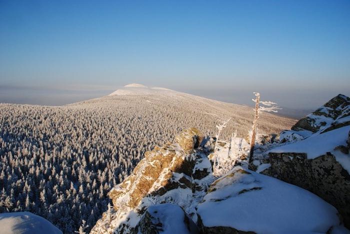
The relief of the Ural Mountains is the main watershed ridge and several side ridges separated by wide depressions. In the Far North there are glaciers and snowfields, in the middle part there are mountains with smooth peaks.
The Ural Mountains are old, they are about 300 million years old, they are noticeably handled by erosion. The highest peak, Mount Narodnaya, is about two kilometers high.
The watershed of large rivers passes along a mountain range: the rivers of the Urals belong mainly to the basin of the Caspian Sea (Kama with Chusovoy and Belaya, Ural). Pechora, Tobol and others belong to the system of one of the largest rivers of Siberia - the Ob. On the eastern slope of the Ural many lakes.
The landscapes of the Ural Mountains are mostly forest, there is a noticeable difference in the nature of vegetation on different sides of the mountains: on the western slope there are mostly dark coniferous forests, spruce and fir forests (in the Southern Urals there are mixed and broad-leaved forests), on the eastern slope there are light coniferous pine-larch forests. In the south - forest-steppe and steppe (mostly plowed up).
The Ural Mountains have long been interested in geographers, including from the point of view of their unique location. In the epoch of ancient Rome, these mountains seemed so far away to scientists that they were seriously called Riphean or Ripey: literally from the Latin, “coastal”, and in the extended sense, “mountains on the edge of the earth”. They received the name Hyperborean (from the Greek "extreme northern") on behalf of the mythical country Hyperborea, it was used for a thousand years, until in 1459 the Fra-Mauro world map appeared, on which the "end of the world" was already shifted beyond the Urals.
It is believed that the mountains were discovered by the Novgorodians in 1096, during one of the trips to Pechora and Ugra by a team of Novgorod ushkuynikov who were engaged in fur trade, trading and collecting yasak. No name was given to the mountains then. At the beginning of the XV century. Russian settlements appeared on the upper Kama - Anfalovsky town and Sol-Kama.
The first known name of these mountains is contained in documents of the turn of the 15th — 16th centuries, where they are called Kamen: this is how any large rock or cliff was called in Ancient Russia. On the "Great Drawing" - the first map of the Russian state, compiled in the second half of the XVI century. - Ural is designated as the Big Stone. In the XVI — XVIII centuries. The name Belt appears, reflecting the geographical position of the mountains between the two plains. There are such variations of names as Big Stone, Big Belt, Stone Belt, Big Belt Stone.
The name "Ural" was originally used only for the territory of the Southern Urals and was taken from the Bashkir language, which meant "height" or "elevation". By the middle of the XVIII century. the name "Ural Mountains" is already applied to the entire mountain system.
ALL TABLE OF MENDELEEV
This figurative expression is resorted to whenever it is necessary to give a short and colorful description of the natural riches of the Ural Mountains.
The antiquity of the Ural Mountains created unique conditions for the development of mineral resources: as a result of prolonged destruction by erosion, the deposits literally surfaced. The combination of energy sources and raw materials predetermined the development of the Urals as a mining region.
For a long time, iron, copper, chromium and nickel ores, potash salts, asbestos, coal, precious and semiprecious stones - Ural gems, are mined here. From the middle of the 20th century oil and gas fields are being developed.
Russia has long since mastered the lands adjacent to the Ural Mountains, occupying Komi-Permian towns, annexing the Udmurt and Bashkir territories: in the middle of the XVI century. after the defeat of the Kazan Khanate, a large part of Bashkiria and the Kama part of Udmurtia voluntarily became part of Russia. A special role in securing Russia in the Urals was played by the Ural Cossacks, which received the highest permission to engage in free-grain farming here. The Stroganov merchants laid the foundation for the purposeful development of the riches of the Ural Mountains, having received from Tsar Ivan IV a awarded diploma for the Ural lands "and what is in them".
At the beginning of the XVIII century. large-scale factory construction began in the Urals, caused by the needs of both the country's economic development and the needs of the military departments. Under Peter I, copper smelting and iron foundries were built here, and later large industrial centers formed around them: Yekaterinburg, Chelyabinsk, Perm, Nizhny Tagil, Zlatoust. Gradually, the Ural Mountains were in the center of the largest mining region of Russia, along with Moscow and St. Petersburg.
In the era of the USSR, the Urals became one of the industrial centers of the country, the most famous enterprises are the Ural Heavy Engineering Plant (Uralmash), the Chelyabinsk Tractor Plant (ChTZ), the Magnitogorsk Metallurgical Plant (Magnitogorsk). During the Great Patriotic War, industrial production from the Soviet territories occupied by the Germans was exported to the Urals.
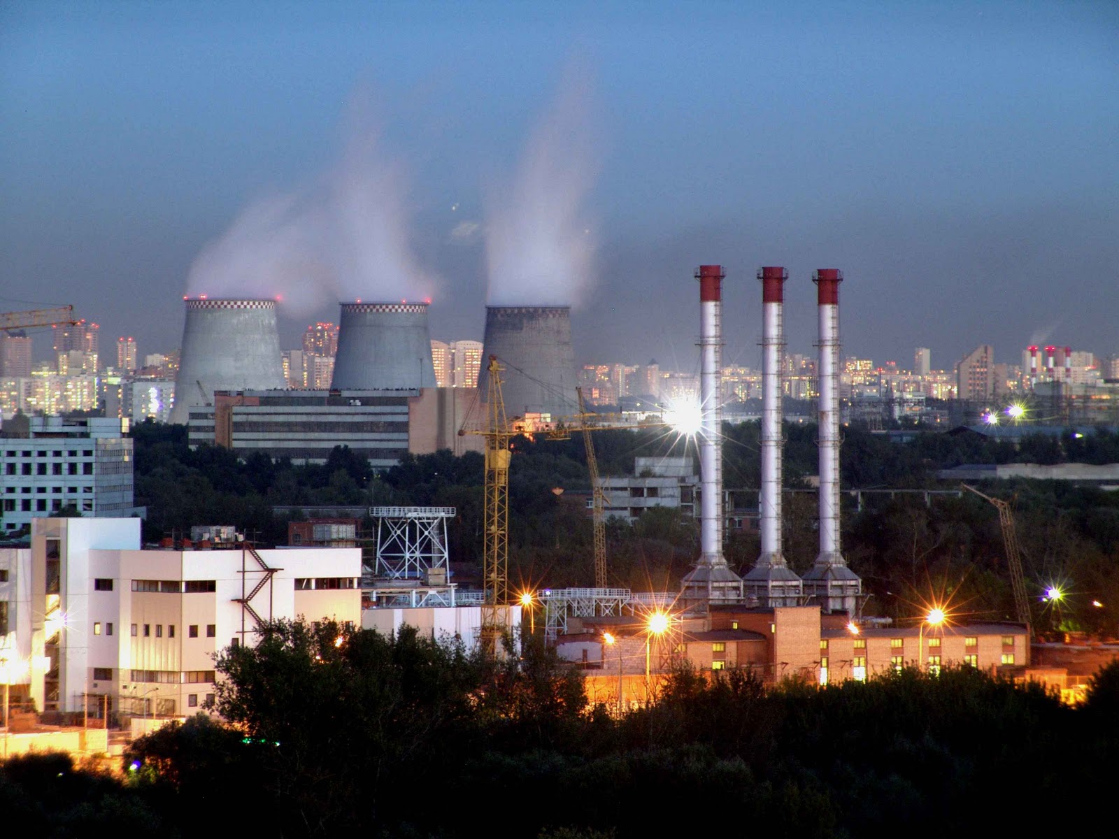
In recent decades, the industrial significance of the Ural Mountains has noticeably decreased: many deposits are almost exhausted, the level of environmental pollution is quite large.
The bulk of the local population lives on the territory of the Ural economic region and in the Republic of Bashkortostan. In the more northern areas belonging to the North-West and West-Siberian economic regions, the population is extremely rare.
During the industrial development of the Ural Mountains, as well as the plowing of the surrounding lands, hunting and deforestation, the habitats of many animals were destroyed, and many species of animals and birds disappeared, among them the wild horse, saiga, bustard, little bastard. Herds of deer that were previously grazing all over the Urals have now migrated deep into the tundra. However, the measures taken to protect and reproduce the fauna of the Urals were preserved in the reserves of the brown bear, wolf, wolverine, fox, sable, ermine, and lynx. Where it has not yet been possible to restore populations of native species, acclimatization of imported individuals is successfully carried out: for example, in the Ilmensky Reserve - sika deer, beaver, maral, raccoon dog, American mink.
SIGHTS OF URAL MOUNTAINS
Natural:
■ Pechora-Ilychsky, Visimsky, “Basegi”, South-Uralsky, “Shulgan-Tash”, Orenburg Steppe, Bashkirsky nature reserves, Ilmensky mineralogical nature reserve.
■ Cave Divya, Arakaevskaya, Sugomakskaya, Kungurskaya ice and Kapova.
■ Rocky Outcrops of the Seven Brothers.
■ Devil's Settlement and Stone Tents.
■ Bashkir National Park, Yugyd Va National Park (Komi Republic).
■ Hoffmann Glacier (Saber Range).
■ Azov-mountain.
■ Alikaev Stone.
■ Nature Park Deer Ruchi.
■ Pass Blue Mountains.
■ Threshold of Howler (Iset river).
■ Zhigalan waterfalls (Zhigalan river).
■ Aleksandrovskaya Sopka.
■ Taganai National Park.
■ Ustinovsky canyon.
■ Gumerovskoe gorge.
■ spring Red Key.
■ Sterlitamak shihans.
■ Red Krucha.
■ Sterlitamak shihans in Bashkiria are ancient coral reefs that formed at the bottom of the Perm Sea. This amazing place is located near the town of Sterlitamak and represents several high hills of conical shape. A unique geological monument, whose age is more than 230 million years.
■ The peoples of the Urals still use the names of the Urals in their own languages: Mansi - Ner, Khanty - Kev, Komi - Iz, Nenets - Pe or Igarka Pe. In all languages, this means the same thing - "stone". Among the Russians who have long lived in the north of the Urals, there is a tradition to also call these mountains Kamen.
■ From the Ural malachite and jasper made the bowls of the St. Petersburg Hermitage, as well as interior decoration and the altar of the St. Petersburg Church of the Savior on Spilled Blood.
■ Scientists have not yet found an explanation for the mysterious natural phenomenon: in the Ural lakes of Uvildy, Bolshoy Kisegach and Turgoyak, unusually clear water. In the neighboring lakes it is completely muddy.
■ The top of Mount Kachkanar is a collection of bizarre-shaped rocks, many of which have their own names. The most famous of them is the camel rock.
■ In the past, the richest deposits of high-grade iron ore from the mountains Magnetic, High and Grace, known throughout the world and listed in all geology textbooks, are now either dug up or turned into quarries hundreds of meters deep.
■ The ethnographic image of the Urals people was created by three flows of immigrants: Russian Old Believers who fled here in the XVII – XVIII centuries, peasants transferred to the Ural factories from the European part of Russia (mainly from modern Tula and Ryazan regions) and Ukrainians attracted as an additional labor force at the beginning XIX century.
■ In 1996, the Yugyd Va National Park, together with the Pechora-Ilychsky Reserve, with which the park borders on the south, was included in the list of UNESCO World Heritage Sites under the name “The Virgin Komi Forests”.
■ Alikaev Kamen - 50-meter cliff on the river Ufa. The second name of the rock - Marin cliff. Here they filmed the TV movie "Shadows disappear at noon" - about life in the Ural province. It was from Alikaev Stone, according to the plot of the film, that the Menshikov brothers dropped the collective farm chairman Marya Krasnaya. Since then, the stone appeared second name - Marin cliff.
■ Zhigalan waterfalls on the Zhigalan river, on the eastern slope of the Kvarkush ridge, form a cascade of 550 m length. With a length of about 8 km, the difference in height from source to mouth is almost 630 m.
■ The Sugomak Cave is the only 123-m-long cave in the Ural Mountains, formed in marble. There are only a few such caves on the territory of Russia.
■ Spring Red Key is the most powerful water source in Russia and the second largest in the world after the Fontaine de Vaucluse source. The water consumption of the spring Red Key - 14.88 m3 / sec. Landmark of Bashkiria in the status of a hydrological nature monument of federal significance.
GENERAL INFORMATION
Location: between the East European and West Siberian plains.
Geographical division: Pai-Khoi range. The Polar Urals (from Konstantinov Kamen to the headwaters of the Khulga River), Subpolar Urals (the section between the Khulga and Shchugor Rivers), the Northern Urals (Howl) (from the Shchugor River to Kosvinsky Stone and Oslyanka Mountain), the Middle Urals (Shore) (from the mountain Oslyanka to the river Ufa) and South Ural (the southern part of the mountains below the city of Orsk), Mugodzhary ().
Economic regions: Ural, Volga, North-West, West Siberian.
Administrative affiliation: Russian Federation (Perm, Sverdlovsk, Chelyabinsk, Kurgan, Orenburg, Arkhangelsk and Tyumen regions, Udmurt Republic, Republic of Bashkortostan, Komi Republic), Kazakhstan (Aktobe region).
Major cities: Yekaterinburg — 1,428,262 people. (2015), Chelyabinsk - 1,182,221 people. (2015), Ufa - 1,096,702 people. (2014), Perm - 1,036,476 people. (2015), Izhevsk - 642,024 people. (2015), Orenburg — 561,279 people. (2015), Magnitogorsk - 417,057 people. (2015), Nizhny Tagil - 356,744 people. (2015), Kurgan - 326 405 people. (2015).
Languages: Russian, Bashkir, Udmurt, Komi-Permyak, Kazakh.
Ethnic composition: Russians, Bashkirs, Udmurts, Komi, Kazakhs.
Religions: Orthodoxy, Islam, traditional beliefs.
Monetary unit: ruble, tenge.
Rivers: the Caspian Sea basin (Kama with Chusovoy and Belaya, Ural), the Arctic Ocean basin (Pechora with Usoy; Tobol, Iset, Tura belong to the Ob system).
Lakes: Tavatuy, Argazi, Uvildy, Turgoyak, Great Shchuchye.
CLIMATE
Continental.
The average January temperature: from -20 ° C (Polar Urals) to -15 ° C (South Urals).
The average July temperature: from + 9 ° С (Polar Urals) to + 20 ° С (South Urals).
The average annual rainfall is: Subpolar and Northern Urals - 1000 mm, Southern Urals - 650-750 mm.
Relative humidity: 60-70%.
ECONOMY
Minerals: iron, copper, chromium, nickel, potash salts, asbestos, coal, oil.
Industry: mining, ferrous and nonferrous metallurgy, heavy machinery, chemical and petrochemical, fertilizers, electrical.
Hydropower: Pavlovskaya, Yuma-guzinskaya, Shirokovskaya, Iriklinskaya HPP.
Forestry.
Agriculture: plant growing (wheat, rye, garden crops), animal husbandry (cattle, pig breeding).
Traditional crafts: artistic processing of the Ural semi-precious stones, knitting of Orenburg downy shawls.
Services: tourist, transport, shopping.
The Ural Mountains are considered the oldest on earth, they stretch from north to south, dividing Russia into European and Asian parts. Mountains begin at the Arctic Ocean, cross the entire country and end in Kazakhstan.
If you look at the map, it can be seen clearly.
The highest of these mountains is in the north, and its height is almost 2 kilometers.
The width of the Ural Mountains in some areas reaches 150 km!
The existence of the Ural Mountains was known in antiquity, in particular, the Greeks believed that, precisely, behind these mountains lies the legendary country of Hyperborea.
Geology of the Urals
The Ural Mountains were not always so low. Their formation began 350 million years ago and during their “youth” the Ural mountains reached a height of six kilometers. There was a time, volcanoes acted in the mountains, strong earthquakes shook all living things, and magma, pouring out, formed new rocks.
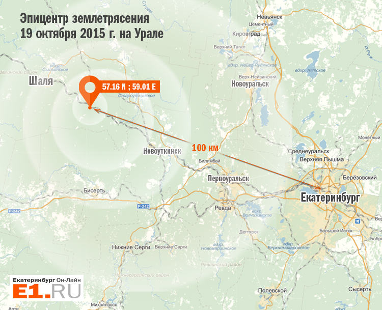
The future mineral deposits were laid here. Millions of years have passed, there are no more crazy volcanoes, the mountains have collapsed and become small, but sometimes the Ural Mountains remember the dawn of stormy youth and earthquakes occur. The last happened in the fall of 2015.
Ural nature
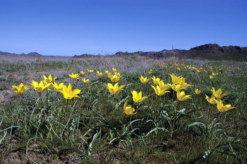
Throughout the mountain there are several natural zones — from the tundra in the north, with taiga in the middle and ending in the south with a steppe.
It turns out that nature and the animal world are different everywhere.
If in the north you can meet a deer, then in the south there is a groundhog or gopher. When tulips are blooming in the south in the steppe, bitter cold is still in the north.
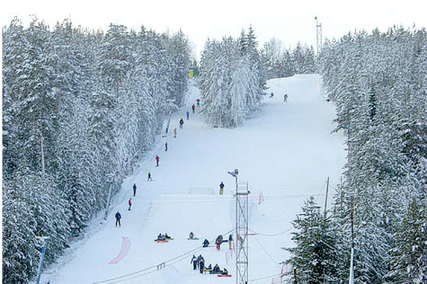
The mountain slopes are not steep, but they perfectly interfere with the winds, therefore the climate of the European part differs from the climate of the Asian part of the mountains, and that is why tourists and skiers from all over the world attract the tourists by taking advantage of their great popularity.
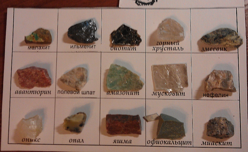
Ural rocks
In the depths of the Urals is located and mined a lot of minerals. Some of them are very rare and are found only in the depths of the Ural Mountains. From the most famous can be identified:
- gold;
- silver;
- iron ore;
- copper ore;
- ornamental stones;
- oil;
Everyone knows crafts and jewelry made of malachite, a beautiful green Ural stone.
Products from it can be seen in the St. Petersburg Hermitage.
Many folk tales about the extraction of fossil wealth were processed by the storyteller Bazhov P.P.
The population of the Urals
The majority of the population lives in large industrial cities. According to the national composition, they are mostly Russians. Next come the Tatars, Bashkirs, Ukrainians, Kazakhs, Mansi, Khanty and other nationalities.
Ural industry
In the Ural region, in particular, in and, the most common industries are metallurgy and mechanical engineering. It is known that even before our era, copper ore was mined here. Modern, the period of development of metallurgy began under Peter I, with the Demidov factories and mines.
The industrial cities of Chelyabinsk, the capital of the Southern Urals with its ChTPZ, and, like the capital of the Urals, with its Uralmash are known all over the world.
All cities of the region have rail, road and air links.
The only disadvantage is that highly developed industry pollutes the atmosphere and adversely affects people's health.
However, this does not stop those who know that the Ural Mountains are natural and want to plunge into this atmosphere.
Fascinating to you travel and excursions to the Ural mountains.
The Ural Mountains are a mountain system located between the West Siberian and East European plains, and represent a kind of border separating Europe from Asia. They were formed by the collision of African and Eurasian lithospheric plates, as a result of which one of them literally trampled the other under itself. From the point of view of geologists, these mountains arose in a complex way, since they consist of rocks of different ages and types.
With a length of more than 2000 km, the Ural Mountains form the Southern, Northern, Subpolar, Polar and Middle Urals. Because of their length, they were called the Earth belt in the first mentions of the 11th century. Everywhere there you can see crystal clear mountain streams and rivers, which then pour out into larger bodies of water. The following large rivers flow there: Kama, Ural, White, Chusovaya and Pechora.
The height of the Ural Mountains does not exceed 1895 meters. So, is the average level (600-800 m) and the narrowest in width of the ridge. This part is characterized by peaked and sharp forms with steep slopes and deep valleys. The highest rise (1500 m) has the top of Pye-Yer.
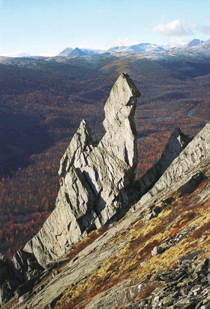
The subpolar zone is expanding slightly and is considered the highest part of the ridge. Here are the following peaks: Mount Narodnaya (1894 m), which is the highest, Karpinsky (1795 m), Saber (1425 m) and many other Ural Mountains, the average height of which ranges from 1300 to 1400 meters. 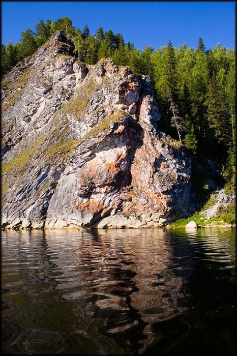 They are also characterized by sharp landforms and large valleys. This part is also notable for the fact that there are several glaciers here, the largest of them stretches almost 1 km in length.
In the northern part of the Ural Mountains, whose height does not exceed 600 meters, are characterized by smooth and rounded shapes. Some of them, composed of crystalline rocks, take on funny shapes under the influence of rain and wind. Closer to the south, they become even lower, and in the middle part they take the form of a gentle arc, where the most significant mark (886 m) is occupied by the peak Kachkanar. The relief here is smoothed and more flat.
In the southern zone, the Ural Mountains rise markedly, forming many parallel ridges. From the highest points, one can note (1638 m) Yamantau and (1586 m) Iremel, the rest - slightly lower (Bolshoy Sholom, Nurgush, etc.).
 In the Urals, in addition to the beautiful mountains and caves, there is a very picturesque, diverse nature, as well as many other attractions. And so it is so attractive to many tourists. Here you can choose routes for people of different levels of training - both for beginners and for fans of extreme travel. In addition to all other advantages, the Ural Mountains are a storehouse of minerals, which include: ores of copper, chromium, nickel, titanium; placers of gold, platinum, silver; deposits of coal, gas, oil; precious malachite, diamonds, yamsha, crystal, amethyst, etc.).
As they say, only mountains can be better than mountains. And this is true, because their indescribable atmosphere, beauty, harmony, majesty and clean air inspire and charge with positive, energy and vivid impressions for a long time.
The length of the Ural Mountains from south to north is 2 thousand kilometers, and from west to east is from 50 to 150 kilometers. In ancient times, the mountains of the Urals were called Riphean, and until the XVIII century "belt" (in translation from Turkic, "Ural" means belt). Since ancient times, the Urals has been considered the natural boundary separating two parts of the world - and. The Ural Mountains are relatively low: only a few peaks reach a height of 1.5 thousand meters above sea level, and the highest of them (Narodnaya Mountain) reaches 1895 meters.
The area occupied by the Urals, is approaching 400,000 km2, and if we count all the foothills, then to 1,100,000 km2. The main ridge is lower than the parallel ridges accompanying it. Its western slope is gently sloping, and the eastern slope is steep. On the western side there is a large part of parallel ridges, with higher peaks in the south than the main ridge. In many places, the Urals are not impressed by a significant mountain range due to the gradual ascent, especially if they are approaching it from the west. There are no peaks along the whole length with constant snow, even in the far north. In relation to the Urals can be divided into several parts: Polar, Polar, North, Middle and South.
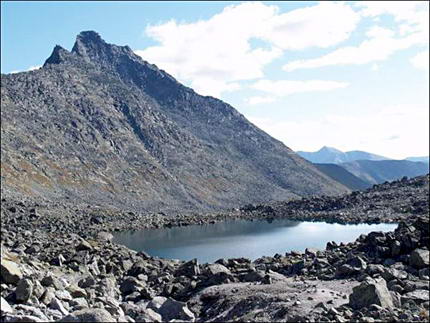
Slope Peoples. One of the highest points of the Ural Mountains
Polar Urals
The northernmost part of the Urals consists of stony placers (rocks and outcroppings). Flora and fauna are quite scarce. Even mosses and lichens do not create a continuous cover. The most significant peaks are the mountains: Payer (1472 meters) and Konstantinov Kamen (492 meters).
Subpolar Ural
This part of the Urals is characterized by the greatest heights of the ridges. Here traces of glaciation are seen quite clearly. Even the names of the mountains speak eloquently of their pointed tops (Blade peak, Mount Saber). Here is the highest point of the Ural Mountains (Mount Narodnaya). Stone peaks and mountain at the bottom of the slope here are replaced. The southern boundary of this part of the Urals is located at 64 ° north latitude.
Northern Urals
The mountains here take on the character of a real range, rather high, rocky and completely treeless. Then the ridge takes a southwest direction. Further to the south-west the ridge narrows and covers its slopes. To the south there is a mountain site with one of the highest points of the Urals - Mount Telposiz (1617 meters). Further to the south, the heights of individual peaks drop to 1000 meters, and then even lower. In general, the average height of the Northern Urals is about 900 meters. On its slopes originate numerous rivers, forming in the west tributaries of the Pechora and Kama, and in the east - the Ob.
Ural Mountains
Middle Ural
The Middle Urals starts from the mountain Yurma, located at the source of the river Ufa. It also mostly consists of two parallel ridges, and the western one is lower, but forms a watershed line between Europe and Asia, and the eastern one is higher. The most elevated peaks are the following: Denezhkin Stone (1492 meters), Konzhakovsky Stone (1569 meters). Further in the south, the heights decrease, and the width of the ridge also becomes smaller. In the Ural region in its northern part is low (never exceeds 700 meters), while its slopes are very gentle here. Further to the south, the ridge gradually rises (up to 850 meters). Numerous spurs (branches of the ridge) are separated from the west, extending to the Kama and the Volga River, while the eastern spurs rapidly decline and merge with the West Siberian Plain.
Southern Urals
The southern part of the Urals consists of the main but lower ridge and the parallel ridges accompanying it. Its western slope is gently sloping, while the eastern slope is steep and steep. To the west of the main ridge is a series of meridional ridges with a general direction from the northeast to the southwest. The highest point is Mount Yamantau (1640 meters). In general, the farther from the central part of the ridge of the Ural to the west, the lower the height and the transition to the weakly undulating terrain of the Ural region takes place very gradually. On the contrary, on the eastern side of the Urals already in a short distance from it, the terrain almost completely loses its mountain character and presents a completely flat surface. The rivers of this part of the Urals are different in nature, depending on the slope from which they originate.
The Ural Mountains are located between different tectonic structures (the Russian Platform and the West Siberian Plate), which explains their formation. The Ural trough, which consists of the sedimentary and continental climate of Western Siberia, separates the Urals from the Russian. reach the western slope of the Urals, trying to overcome it, rise above and cool. As a result, more precipitation falls in the western part of the Urals than in the eastern part (approximately 1.5-2 times). Temperature regime also has its own characteristics. In the western part of the Urals, winter is more snowy and, accordingly, more mild. In the east, the snow falls less, and the frost reaches 45-50 ° C.
In the Urals, a fairly large number of rivers, the largest of which flow from east to west. In this area are also about 6 thousand.
In the ancient sources the Ural Mountains were called Riphean or Hyperborean. Russian pioneers called them "Stone". The toponym "Ural" is most likely taken from the Bashkir language and means "stone belt". The name was introduced by the geographer and historian Vasily Tatishchev.
How did the Ural
The Ural Mountains stretch a narrow strip of more than 2000 km from the Kara Sea to the steppes of the Aral Sea region. It is assumed that they originated about 600 million years ago. Some scientists believe that several hundred million years ago, Europe and Asia broke away from the ancient continents, and gradually drawing closer, they collided with each other. In the places of collision, their edges were crushed, some part of the crust was squeezed out, something, on the contrary, went inside, cracks and folds were formed. Giant pressure led to delamination and melting of rocks. The structures pressed to the surface formed a chain of Ural mountains - a seam connecting Europe and Asia.
The movements and breaks of the earth's crust have not happened here once. For several tens of millions of years, the Ural Mountains were subjected to the ravages of all natural elements. Their tops smoothed, rounded, became lower. Gradually, the mountains acquired a modern look.
There are plenty of hypotheses explaining the formation of the Ural Mountains, but the theory of a seam connecting Europe and Asia makes it possible to more or less intelligibly link together the most contradictory facts:
- being almost on the surface of rocks and sediments that can form only deep in the bowels of the Earth in conditions of enormous temperatures and pressures;
- the presence of siliceous plates of clearly oceanic origin;
- sandy river sediments;
- boulder beds brought by the glacier, etc.
The following is unequivocally: The Earth as an isolated cosmic body exists about 4.5 billion years. In the Urals, rocks have been found that are at least 3 billion years old, and no modern scientist denies that the cosmic matter is still decompressioning in the universe.
Ural climate and resources
The climate of the Urals can be defined as mountainous. The Ural ridge serves as a dividing line. To the west of it, the climate is milder and more precipitation falls. To the east - continental, drier, with a predominance of low winter temperatures.
Scientists divide the Urals into several geographic zones: the Polar, Subpolar, Northern, Middle, and Southern. The highest, undeveloped and inaccessible mountains are in the territory of the Subpolar and Southern Urals. Middle Ural is the most populated and developed, and the mountains there are the lowest.
In the Urals, 48 types of minerals have been found - copper-pyrite, skarn-magnetite, titanomagnetite, oxide-nickel, chromite ores, deposits of bauxite and asbestos, coal, oil and gas deposits. Also found deposits of gold, platinum, precious, semi-precious and ornamental stones.
In the Urals, there are about 5,000 rivers flowing into the Caspian, Barents and Kara seas. The rivers of the Urals are extremely heterogeneous. Their features and hydrological regime are determined by differences in terrain and climate. There are few rivers in the Polar Region, but they are abundant. Rapid, rapid rivers of the Subpolar and Northern Urals, originating on the western slopes of the mountains, flow into the Barents Sea. Small and stony mountain rivers, originating on the eastern slopes of the ridge, flow into the Kara Sea. The rivers of the Middle Urals are numerous and abundant. The length of the rivers of the Southern Urals is small - about 100 km. The largest of them are Ui, Miass, Ural, Uvelka, Ufa, Ai, Gumbeika. The length of each of them reaches 200 km.
The largest river in the Ural region, the Kama, which is the largest tributary of the Volga, originates in the Middle Urals. Its length is 1805 km. The total slope of the Kama from the source to the mouth - 247 m.
In the Urals, there are about 3327 lakes. The deepest is the Great Pike Lake.
Russian pioneers came to the Urals together with Ermak's squad. But, according to scientists, the mountainous country has been inhabited since the times of the ice age, i.e. more than 10 thousand years ago. Archaeologists have discovered here a huge number of ancient settlements. Now on the territory of the Urals are the Komi Republic, Nenets, Yamalo-Nenets and Khanty-Mansi Autonomous Districts. The indigenous people of the Urals are the Nenets, the Bashkirs, the Udmurts, the Komi, the Permian Komi and the Tatars. Presumably, the Bashkirs appeared here in the 10th century, the Udmurts appeared in the 5th century, the Komi and Komi-Permyaks appeared in the 10th-12th centuries.
New Articles
- What is the highest peak of the Ural Mountains
- The most ancient religions in the world
- What continents are washed by the Atlantic Ocean?
- Can I wear jewelry of the deceased?
- Snake, Bowl and Staff: The Origin of Medical Symbols
- Interesting facts about hares
- Names of famous brands in other countries
- Karelo Finnish epic kalevala protagonists
- 17 18 weeks pregnant sensations
- Why do people become so aggressive
Popular articles
- Expression twice in one river, meaning and meaning
- Gusli - musical instruments
- Report: Temperature Scales and Thermometers
- Which side to sew on chevron
- How to draw emblems for school
- Unusual rivers of the world and the rivers of Russia - Rivers with sour water
- Numb of the little finger on the right hand: causes and methods of treatment
- Why development is important for a person
- Constellations from ancient atlases
- What happens at 31 weeks